Overview
🏆 Final results and material
The MapSeg challenge ran from November 2020 to April 2021, with 🏆 winners for each three tasks who were invited to co-author the competition report. We would like to thank all participants for their great submissions.
All material is now available:
![]() Competition report
Competition report
![]() Dataset with ground truth
Dataset with ground truth
![]() Participants' submissions, detailed descriptions and evaluation reports
Participants' submissions, detailed descriptions and evaluation reports
![]() Evaluation tools
Evaluation tools
…and material for ICDAR presentation: video teaser, slides, full presentation and poster.
To cite the competition, please cite the competition report:
@InProceedings{chazalon.21.icdar.mapseg,
  author    = {Joseph Chazalon and Edwin Carlinet and Yizi Chen and Julien Perret and Bertrand Dum\'enieu and Cl\'ement Mallet and Thierry G\'eraud and Vincent Nguyen and Nam Nguyen and Josef Baloun and Ladislav Lenc and and Pavel Kr\'al},
  title     = {ICDAR 2021 Competition on Historical Map Segmentation},
  booktitle = {Proceedings of the 16th International Conference on Document Analysis and Recognition (ICDAR'21)},
  year      = {2021},
  address   = {Lausanne, Switzerland},
}
Organized by the LASTIG team of the IGN (the French National Mapping Agency), the R&D Lab. of the EPITA (French engineering school in computer science), and the Center of Historical Studies of the EHESS (French graduate schools of social sciences).
This work was partially funded by the French National Research Agency (ANR): Project SoDuCo, grant ANR-18-CE38-0013. We thank the City of Paris for granting us with the permission to use and reproduce the atlases used in this work.
🗺️ About the competition
This competition consisted in solving several challenges which arise during the digitization of historical maps. We were particularly interested in a large map series consisting in many Paris atlases over half a century (1860's-1940's). For each year, a set of approximately 20 sheets forms a tiled view of the city. Such maps are highly detailed and very accurate even by modern standards. The graphical nature of the content is visible in the full map sheet illustrated below.
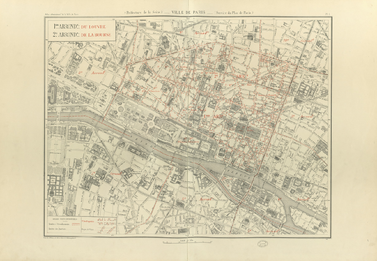 A sample map sheet (link to larger version)
This material provides a very valuable resource for historians and a rich body of scientific challenges for the document analysis and recognition (DAR) community: map-related challenges (overlapping of many information layers) and document-related ones (document preservation).
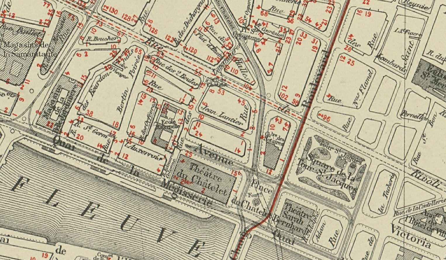 Excerpt showing map-related challenges
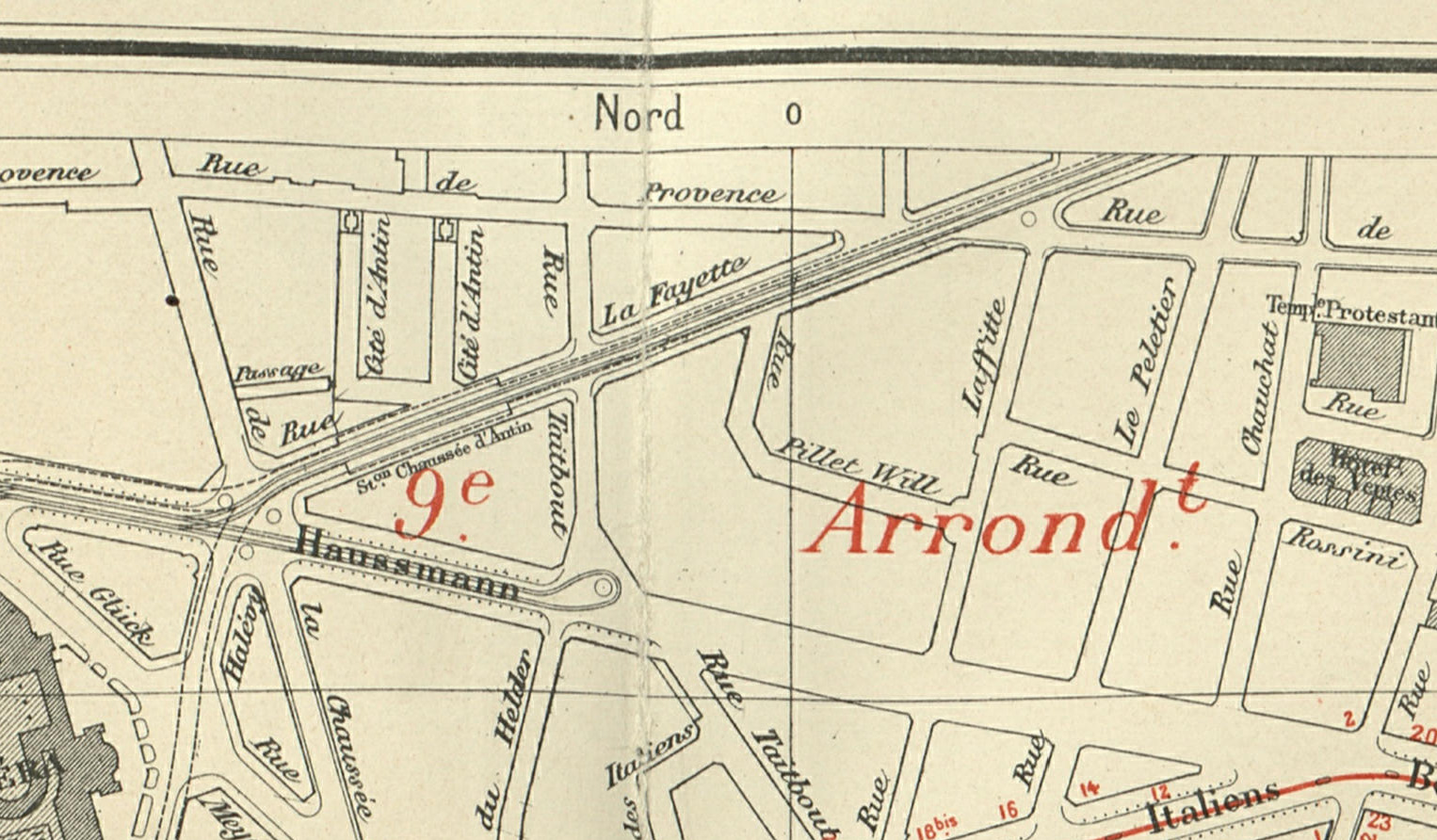 Excerpt showing document-related challenges
We addressed tasks for three levels of scientific problems:
- Task 1: Detection of building blocks
- Task 2: Segmentation of map content within map sheets
- Task 3: Localization of graticule lines intersections
These tasks are necessary step during the digitization of historical maps, i.e. when gradually turning a raster image into a set of vector geometries projected onto a particular geographical coordinate reference system. Automatic approaches with good generalization power will provide an enormous gain for the Geographical Information Systems (GIS) communities looking for solutions when digitizing old maps, and create a great potential for many historical studies.